Global Atmospheric Circulation and Climate
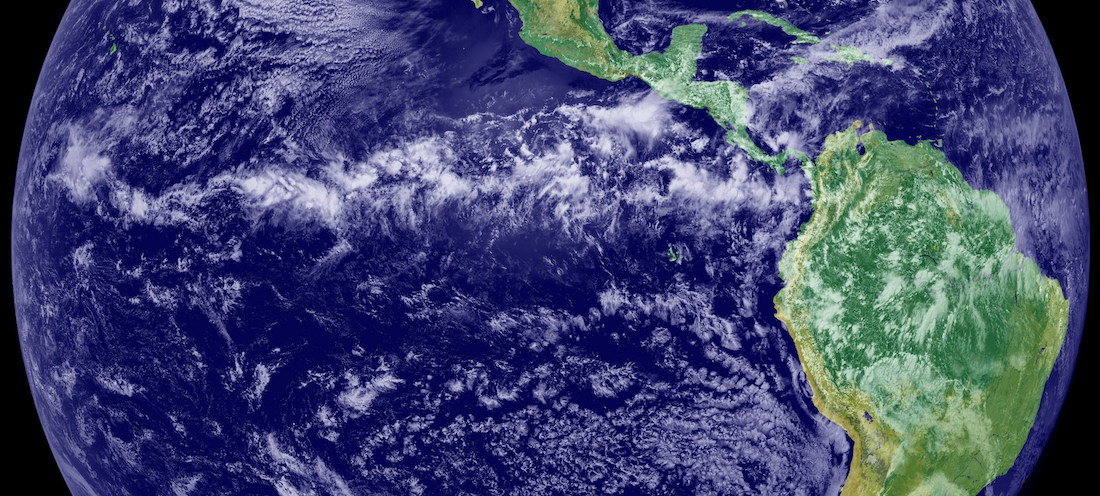
This image is a combination of cloud data from NOAA’s Geostationary Operational Environmental Satellite (GOES-11) and color land cover classification data. The ITCZ is the band of bright white clouds that cuts across the center of the image. Source: NASA Earth Observatory, https://en.m.wikipedia.org/wiki/File:IntertropicalConvergenceZone-EO.jpg (Public Domain)